By Clint Cox, alias “The Panhandle Paddler”
The journey through the Dead Lakes continues this week. I’ll begin this portion of the journey at the area known as West Arm Creek. This dark water creek enters the Lakes from the west and if you are traveling south on Highway 71 you will cross over this creek just before entering the town of Wewahitchka. The creek has many of the same features as the Lakes, with its dark waters and vast graveyard of cypress stumps. As you travel south through the lake you’ll approach West Arm Creek at a landmark known as 5 Stumps. These 5 stumps are found on the northern tip where the creek meets the lake. You’ll know it is West Arm Creek when you see one of these stumps with a black and white ribbon / banner tied around the stump. In fact, there are three or four stumps in and around the creek entrance that have these same black and white ribbons / banners. I paddled about a ½ mile up the creek and it looked to be a prime fishing location, as is much of the Dead Lakes.
In paddling through the Dead Lakes we have been primarily hugging the western shoreline. At West Arm Creek the journey moves toward the eastern shoreline to find a clear channel. This channel however will eventually come to a dead end. When it does, head due west until you catch sight of the Dead Lakes Bridge on Lake Grove Road. When you see the bridge, return to the eastern shoreline to find the main channel. This main channel will take you under the bridge and over the remnants of the old man made dam.
As I wrote last week the Dead Lakes were created naturally over the course of many years. The sediment-laden Apalachicola River deposited its silty sands over its banks, causing a slow-motion jam that eventually created a natural dam on the Chipola River. The ensuing high water from the Apalachicola in the floodplain killed thousands of trees, thus the name Dead Lakes. A man made dam was constructed in 1962 to help maintain a high water level however it was torn down around 1987 when it was realized that the man made dam was doing more harm than good. As I paddled under the bridge, with at least 8-10 feet of clearance, I recalled seeing a picture taken by Dick Hinson in 1986 of Sonny Anderson and his canoe as he went under the bridge with only about two inches of clearance. That was before the dam was removed.
About 200 yards south of the bridge is The Cut, which is where the Chipola River is joined by a segment of the Apalachicola River. The Big River splinters off from its self about a mile upriver and this splinter connects with the Chipola, overtaking The Little River and turning the waters to a muddy red coloration. From here the Chipola, with its new red look, flows 18 miles south to join up with the main channel of the Apalachicola River.
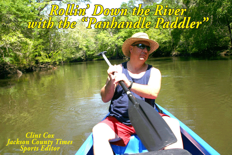
Rollin’ Down the River has been a weekly summertime feature of the Jackson County Times which highlights the Chipola River through pictures, stories and articles. See Simply Put for more on the conclusion of this series.
The journey through the Dead Lakes continues this week. I’ll begin this portion of the journey at the area known as West Arm Creek. This dark water creek enters the Lakes from the west and if you are traveling south on Highway 71 you will cross over this creek just before entering the town of Wewahitchka. The creek has many of the same features as the Lakes, with its dark waters and vast graveyard of cypress stumps. As you travel south through the lake you’ll approach West Arm Creek at a landmark known as 5 Stumps. These 5 stumps are found on the northern tip where the creek meets the lake. You’ll know it is West Arm Creek when you see one of these stumps with a black and white ribbon / banner tied around the stump. In fact, there are three or four stumps in and around the creek entrance that have these same black and white ribbons / banners. I paddled about a ½ mile up the creek and it looked to be a prime fishing location, as is much of the Dead Lakes.
In paddling through the Dead Lakes we have been primarily hugging the western shoreline. At West Arm Creek the journey moves toward the eastern shoreline to find a clear channel. This channel however will eventually come to a dead end. When it does, head due west until you catch sight of the Dead Lakes Bridge on Lake Grove Road. When you see the bridge, return to the eastern shoreline to find the main channel. This main channel will take you under the bridge and over the remnants of the old man made dam.
As I wrote last week the Dead Lakes were created naturally over the course of many years. The sediment-laden Apalachicola River deposited its silty sands over its banks, causing a slow-motion jam that eventually created a natural dam on the Chipola River. The ensuing high water from the Apalachicola in the floodplain killed thousands of trees, thus the name Dead Lakes. A man made dam was constructed in 1962 to help maintain a high water level however it was torn down around 1987 when it was realized that the man made dam was doing more harm than good. As I paddled under the bridge, with at least 8-10 feet of clearance, I recalled seeing a picture taken by Dick Hinson in 1986 of Sonny Anderson and his canoe as he went under the bridge with only about two inches of clearance. That was before the dam was removed.
About 200 yards south of the bridge is The Cut, which is where the Chipola River is joined by a segment of the Apalachicola River. The Big River splinters off from its self about a mile upriver and this splinter connects with the Chipola, overtaking The Little River and turning the waters to a muddy red coloration. From here the Chipola, with its new red look, flows 18 miles south to join up with the main channel of the Apalachicola River.
Rollin’ Down the River has been a weekly summertime feature of the Jackson County Times which highlights the Chipola River through pictures, stories and articles. See Simply Put for more on the conclusion of this series.


No comments:
Post a Comment