The Marianna Lions met Monday August 23rd at Jim’s Buffet and Grill. During the business session a letter from the Chipola Foundation recognized the Lions scholarship contribution. A thank you letter was received from Jessica White regarding her receipt of the club scholarship. The board meeting was changed to September 13th
Clint Cox presented an interesting, entertaining and nostalgic PowerPoint presentation entitled “Rollin Down the River, Panhandle Paddler” His trip was instigated as a result of a story that Dick Hinson told of his and Sonny Anderson’s trip on the Chipola several years earlier. Clint and Chris Mathews took their trip in 2008-09. They took the river a section at a time consisting of 11 segments over 14 days and three nights. Clint first went up the river to its origin at Marshall and Cowart’s Creeks. This area of the river is log and limb strewn and infested with gators. As he took us under storied bridges such as Bellamy, Yancey, and Magnolia bridges, and several railroad trestles he pointed out his colleague’s debunking of ghost stories and the fact that several of these bridges were places that young Jackson, and I presume Calhoun and Gulf County, boys, had to prove their manhood by jumping off a bridge. Several Lions raised their hands, silently testifying to their rite of passage.
This reminded me of our son and a friend who were either testing themselves or trying to earn a merit badge, canoed down the Chipola and coming out of a log run, their canoe capsized, resulting in loss of a pair of glasses and shoes much to their parents consternation. Other sites shown included Christoff’’s Ferry which had a hotel that was built in the 1830’s, Federal Shoals that had a fort and local Indians used Alamo cave as a hiding place. Judge McCrary’s river house was shown, supposedly in a 50 year floodplain. The good judge said that “it made him 250 years old”.
Needless to say the 89 miles of the Chipola from its origins to where it joins the “Big River” below the Dead Lakes, is very storied. The Chipola is also very popular, attracting about 2500 people in tubes, canoes and kayaks on any warm weekend. There are several good internet sites with stories about Panhandle rivers. Including Clint’s Rollin Down the River, Panhandle Paddler and “Voices of the Apalachicola”.
Click Here to go to our Homepage
Thursday, August 26, 2010
Friday, July 2, 2010
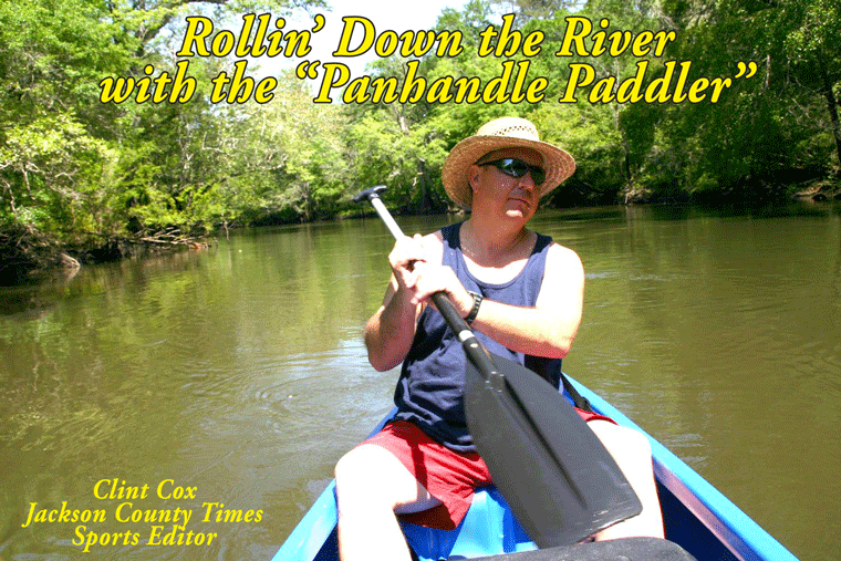
Rollin’ Down the River – The Dead Lakes to The Big River – Part II
By Clint Cox,
alias “The Panhandle Paddler”
Last week we left off our journey on the final leg down the Chipola at Burgess Creek. Traveling south of Burgess Creek the next major stop was that of Lockey Lake. This “lake” comes into the Chipola on the west side and has a nice boat landing known as Bryant’s Landing. My traveling partner, Chris Matthews, and I took a break for lunch here before spotting an interesting site across from the landing. We took note of several “contraptions” that demanded a closer inspection. These contraptions turned out to be swamp logging devices (photo attached) that were anchored up in a little slough.
Just a short paddle from Bryant’s Landing is Douglas Landing on the west bank. This is a small “fish camp” style landing with a concrete ramp and several locations for overnight camping. Another landing on the west bank was spotted just down from Douglas and it is known as Lister’s Landing. This is a small dirt landing but appeared to be in good shape. Across from Lister’s Landing on the east side is Douglas Creek, which loops around and comes back out about a ½ mile down on the east side of the river.
Buck’s Brite was the next site that we checked out and it is a creek coming in on the west side of the river. The creek features a nice sandy beach, swimming area and camping spot. It also featured a house boat tied up at the mouth of the creek. Just a short paddle down from Buck’s Brite we came to the meeting place of the Chipola and Apalachicola River. The two rivers come together just 27 miles north of the town of Apalachicola.
Chris and I checked out a potential camping spot on the Big River but decided to return back up the Chipola to Buck’s Brite for the night. Part of the reason we went back up river was due to a difficult decision that we had to make. The dilemma was whether to paddle down the Big River to the next take out point or paddle back up the Little River to Douglas Landing for our take out the next day. Obviously paddling down river would have been much easier, but there are no take out points on the Big River in close proximity to the Chipola and Apalachicola’s meeting place. So back up river we went and Buck’s Brite turned out to be a right nice camping spot, complete with good shaped, a good swimming hole and a beautiful river front view. That also meant that the next morning was spent paddling back up river to Douglas Landing. That was a tough little paddle but we made it and were able to hitch a ride back to our vehicle for an early exit.
Two interesting aspects were noted on this lower section of the Chipola. First the presence of numerous house boats. Very few turns were taken without the revealing of another batch of these floating houses tied off to the bank. And these floating houses took on every imaginable shape, size, color and condition. The other interesting aspect noted was the style of fishing that we observed. As I mentioned last week this portion of the river has little to no banking. The banks are made up mostly of a variety of trees and bushes hanging out over and even on the water. The folks that fish these parts pull right up into, and amongst these trees and bushes. Casting is out of the question, so they just tight line fish with rod and reels right next to their boat. Given the number of heathly moccasins that we saw down here, I’ll pass on this fishing technique.
With the journey down the Chipola River complete, I take some time over the next couple of weeks to share a few thoughts, and of course more photos, about my journey.
Friday, June 25, 2010
The Dead Lakes to The Big River – Part I
By Clint Cox, alias “The Panhandle Paddler”
For the past two summers we have paddled the Chipola River from her headwaters in Northern Jackson County to the Dead Lakes in Gulf County. The final leg of the journey was to paddle from the southern end of the Dead Lakes to where the Chipola meets up with the Apalachicola River. Folks in Gulf County like to keep it simple so the Chipola is known as the Little River and the Apalachicola is known as “The Big River”. Once again my traveling companion was Chris Matthews, a local veteran with a wealth of paddling and outdoor experience.
Our journey started with a night spent at the Sportsman’s Lodge just outside of Wewahitchka. The lodge and their boat ramp are located right on the waters of The Cut, an off shoot of The Big River that connects with The Little River just below the end of the Dead Lakes. We shoved off our canoes, loaded with our camping gear, early the next morning to a back drop of a beautiful spring morning sunrise. Within moments we had hooked up with The Little River and were on our way.
The eastern banks of the Little River below the Dead Lakes really amounts to an island. This island, which alternates as dry land and swamp land, is surrounded by The Big River, The Little River and The Cut. The most immediate difference in the Chipola down this way is the coloration of the water, which has been darkened by the influx of The Big River. The banking is also very different in that there is practically no banking to speak of. Again the eastern bank is mostly swamp land. The western banking is very low and lined with trees hanging over the river. The western bank also features a fair amount of development along the way. Maddox Slough follows some of these housing areas about an hour south of the Dead Lakes.
Just down from Maddox Slough is an unusual site for this portion of the river. The western bank displays a high bank that is at least 50 feet high and last for about 200 yards. The river then returns to her look of low to no banking with the next notable site a public boat ramp known as Land’s Landing. Shortly thereafter we see a slough to the east, which is called White River and then a creek, Burgess Creek, to the right.
At this point we have paddled about half the distance of this trip. We’ll take a break for this week and come back next week with Part II of our journey to The Big River.
Subscribe to:
Posts (Atom)

